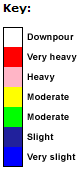
Well Hill Rainfall Radar Well Hill Rainfall Radar
The
image below shows the latest available radar image of rainfall in the
South East of England. The white circles are centred on Well Hill and
are about 15 miles (25 kilometres) apart. When there is rainfall detected
by the radar, small squares of different colours will appear on the image.
Each square represents a 5x5 kilometre area (about 3x3 miles). Even though
rainfall is shown in a square, it is still possible for Well Hill to be
dry as many showers and thunderstorms are very localised and it is possible
to be within 1 kilometre of a downpour but still be in a dry area!
Please be patient as sometimes it takes 30 seconds to retrieve the latest
rainfall radar data.
For recent radar images see the Met
Office web site. This has about 6 hours of historical data.
|